Please note, this site is not being actively maintained.
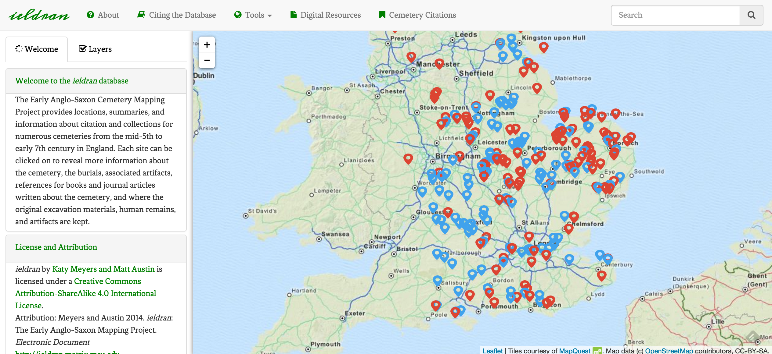
The goal of ieldran: The Early Anglo-Saxon Cemetery Mapping Project is to display all burials in England that date from the mid-5th to early 7th centuries CE with relevant information about each location. While there are numerous studies that have covered this period, there are no open access or shared databases of sites. With this in mind ieldran, meaning ‘ancestors’ in Old English, was created to provide an online geospatial database of all excavated cemeteries from Early Anglo-Saxon England. The project seeks to display excavated cemeteries from this period with information on the burials present, references to books and journals, location of museum collections, and links to other relevant digital material.
The project was built by myself using Bootleaf and Leaflet Hash. Support and technical aid was received through MSU’s Cultural Heritage Informatics Initiative Fellowship program.
Bootleaf is a mash-up framework created by Bryan McBride, and is freely available for download. It is a simple responsive template for building geospatial applications that leverages Twitter Bootstrap 3, Leaflet, and typeahead.js.
Leaflet Hash is a plugin created by Michael Evans that generates dynamic URL hashes to web pages with Leaflet maps that allows you to link users to specific map views. As the user zooms and moves across the map, the URL of the site will change.
All primary data was collected and catalogued by Matt Austin, my content collaborator, as part of his Masters thesis. All of his data is included in his thesis as a Microsoft Access database (.accdb) and as a Microsoft Excel spread sheet (.xlsx).
